Updating Kribi Port’s Geographic Information System (GIS)
Updating Kribi Port's Geographic Information System (GIS)
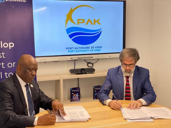
A new partnership signed between PAK and PRODEVELOP SL in Spain
On March 22, 2022, in Valencia, Spain, the Kribi Autonomous Port (PAK) signed a strategic partnership agreement with PRODEVELOP SL, a company specialized in port system development.
This agreement aims to upgrade and enhance the Port’s Geographic Information System (GIS) — a key digital tool for smart territorial management.
Implemented in October 2021, the GIS is designed to support the coordinated planning of physical investments, aligning with long-term sustainable development goals. It provides accurate and dynamic mapping of the port and its industrial zone to ensure balanced and efficient growth.
This partnership reflects PAK’s ongoing technological transformation strategy, reinforcing its position as a modern, forward-looking seaport in the Gulf of Guinea.