Strengthening GIS Capabilities: PAK Takes Part in Advanced GeoServer Level II – PostGIS Training

Strengthening GIS Capabilities: PAK Takes Part in Advanced GeoServer Level II - PostGIS Training
A key milestone in the modernization of Kribi Port Authority’s Geographic Information System
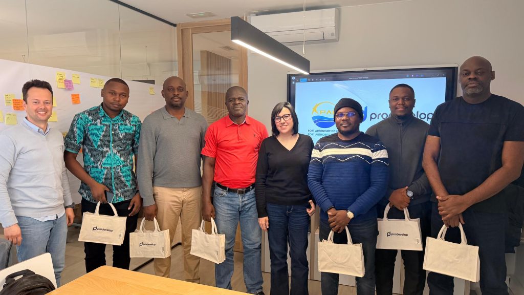
From November 4 to 7, 2025, a delegation from the Kribi Port Authority (PAK) took part in a hands-on GeoServer Level II – PostGIS training held in Valencia, Spain. Delivered by Prodevelop/TW Micronics, this session aimed to enhance participants’ technical skills in administering and managing the GeoServer mapping server, a core component of PAK’s Geographic Information System (GIS).
As part of the ongoing modernization of its Geographic Information System (GIS), the Port Authority of Kribi (PAK) participated in an advanced GeoServer Level II – PostGIS training from November 4 to 7, 2025, in Valencia, Spain.
The training, organized and conducted by Prodevelop/TW Micronics, had two main objectives:
-
To strengthen participants’ skills in administering the GeoServer platform, a central element of PAK’s GIS architecture facilitating the sharing and dissemination of geographic data across departments;
-
To ensure a transfer of technical knowledge necessary for mastering the GIS source code and maintaining long-term operational autonomy.
The program combined theoretical and practical sessions, featuring:
-
Presentations on the fundamental concepts and principles of GeoServer;
-
Demonstrations led by trainers;
-
Interactive exercises and practical implementations by participants.
Key modules covered included:
-
GeoServer fundamentals;
-
Management and operation of the mapping server;
-
Advanced administration and optimization techniques.
By taking part in this high-level training, the Port Authority of Kribi reaffirms its commitment to building internal expertise, improving its digital infrastructure, and promoting efficient and secure data sharing across its operational units.